|
| Image | 1 | 2 | 3 | 4 | 5 | 6 | 7 | 8 | 9 | 10 | 11 | 12 | 13 | 14 | 15 | 16 | |
|
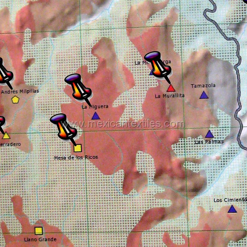 |


| 16 | Documentation of tepehuano indigenous textiles from Huajicori, Nayarit, Mexico. The grey line on the right is the border with the State of Durango. This segment of map is from the National Institute of Indigenous languages. | maptepehuanos | maptepehuanos.jpg |
| Headline: Mexican IindigenousTextiles Study | Copyright: Robert Edward Freund 2009 | Caption: Documentation of tepehuano indigenous textiles from Huajicori, Nayarit, Mexico | Keywords: Mexico Nayarit Tepehuanos Huaicori indigenous dress Sierra Huajicori Huajicori San Andres Millpillas La Higera Muralitos Mesa de Los Ricos curandero | See map |
| Total images: 16 | Mexican Indigenous textile project | Museum Store | Made with JAlbum & Chameleon | Help |